Typhoon Sadel Bears Down on Zhejiang as Red Alert Urges Maximum Defense
China forced coastal Zhejiang onto top-level alert as Typhoon Sadel intensified into a strong storm on August 27, with forecasters warning it could come ashore between Wenzhou and Fujian the next morning. The provincial command ordered ships into port, reservoirs drained, and high-risk communities moved out overnight.
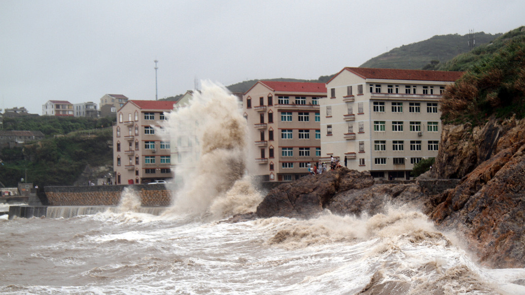
Residents along the coast of eastern Zhejiang province moved to shelter on August 27 as Typhoon Sadel, the season's 18th named storm, strengthened beyond forecast and triggered a red warning, China's highest. The Central Meteorological Observatory said the storm could make landfall between Wenzhou in Zhejiang and Xiapu in Fujian on the morning of August 28, with no rule out that it would strike near Yuhuan's Kanmen.
The province itself had begun treating the storm as an emergency hours earlier. That afternoon, Zhejiang's third-order command of the year directed every level of government to activate the province's round-the-clock command system, evacuate people from high-risk zones while the daylight window lasted, and pre-position pumping vehicles, satellite phones and generators in coastal counties. State broadcaster Zhejiang Blue reported. Earlier, the provincial flood-control office said Ningbo, Zhoushan and Taizhou were already inside the storm's gale-force wind circle.
What made Sadel unusual was its path. After moving steadily northwest, the system turned southwest in the early hours of August 27, a turn meteorologists described as comparatively rare. It also mattered for a coastline that had already absorbed a crowded stretch of typhoons this month: officials noted four storms formed within six days in mid-August, and a new system, the 22nd, spun up that afternoon.
Typhoons are a recurrent fact of coastal life in China, and the response that accompanies them has become a scheduled drill as much as a disaster. The Zhejiang order spelled out familiar but strict thresholds: halt work, schools, markets and transport where wind and rain reach set levels; confirm every elderly resident in a nursing home has moved; ensure each shelter holds 72 hours of basic supplies; and keep local cadres with evacuees through the night. The language was bureaucratic, but the object was concrete: keep people away from storm surge, landslides and flooding before the wind arrives.
By evening, the National Meteorological Center had widened the warnings beyond wind. It issued a red alert for ocean waves and an orange alert for storm surge, while the Ministry of Water Resources said portions of rivers could exceed warning levels and ordered basin reservoirs to be drawn down ahead of the rain. The defense ministry, the emergency management ministry and the National Defense Council all had notices running in the space of a few hours.
Sadel's approach is unlikely to alter how outsiders understand Chinese coastal resilience, but it does show the machinery at scale: warnings that cascade from a national observatory down to county magistrates, and a population that knows the routine of boats drawn into harbor, windows taped, and township officials moving door to door. The uncertain question is what the late turn will mean for the coastline's most exposed points, rather than whether the system can respond.